35.10.080 Marine Waterfront designation (MWf).
(1) Criteria. The Marine Waterfront designation is applied to shoreline areas landward of the ordinary high water mark found along portions of the Clallam Bay-Sekiu Urban Growth Area marine waterfront and at existing isolated, rural and resource land locations characterized as moderately to mostly developed with existing intensive, marine water-oriented commercial or recreational uses or transportation uses. These shorelines are characterized as also having a preponderance of the following characteristics:
(a) Native forest cover has been cleared or is highly fragmented with minimal or no native riparian vegetation;
(b) Shoreline is modified with over-water and in-water structures, including breakwaters, piers, and/or marinas supporting water-oriented uses; or
(c) Shoreline is partially or entirely armored with structural armoring such as bulkheads.
(2) Purpose. The purpose of the Marine Waterfront designation is to accommodate high intensity marine water-oriented commercial, recreational and transportation uses while protecting existing ecological functions and restoring ecological functions in areas that have been previously degraded.
(3) Management Policies. The Marine Waterfront environment should be managed consistent with the following policies:
(a) Shoreline permitted, conditional and prohibited uses, developments, and modifications are to be based on Tables 2-1 and 2-2, and as further prescribed by the policies and regulations of this Program for specific shoreline uses, developments and modification activities. All shoreline uses must also be a permitted use under the Clallam County Zoning Code, CCC Title 33.
(b) New uses, developments, and shoreline modification activities are subject to the prescribed policies and regulations of this Program addressing shoreline buffer and vegetation conservation, critical area protection, clearing, grading and filling, water quality and water management, public access, and archaeological, historical and cultural resources.
(c) The scale, intensity, and density of new uses and development should be compatible with, and protect or enhance, the existing recreational and/or mixed use character of the area while sustaining shoreline ecological functions and processes.
(d) Access, utilities, and public services should be available and adequate to serve existing needs and/or planned future development.
(e) Where feasible, proposals for new development should include environmental cleanup and/or restoration of past shoreline damage or degradation.
(f) Where feasible, proposals for new development should provide visual and physical public access to the water.
(g) Property owners should be made aware these areas may be subject to hazards such as storm surges, flooding, erosion caused by wind and waves, and/or channel migration even where there are bulkheads, levees, or other flood/erosion protection structures in place through a targeted marketing outreach program implemented by Clallam County.
(h) Construction of new structural shoreline stabilization and flood control structures should only be allowed where there is a documented need to protect an existing structure or where restoration of ecological functions is the primary purpose. New development should be designed and located to preclude the need for new structural shoreline stabilization and flood control structures.
(i) Scientific, historical, cultural, and educational uses may be allowed provided no ecological adverse impact on the area will result.
(4) Areas Designated. The general location and approximate extent of the Marine Waterfront environment is shown on the Shoreline Environmental Designation Maps in Exhibit A of this Program.
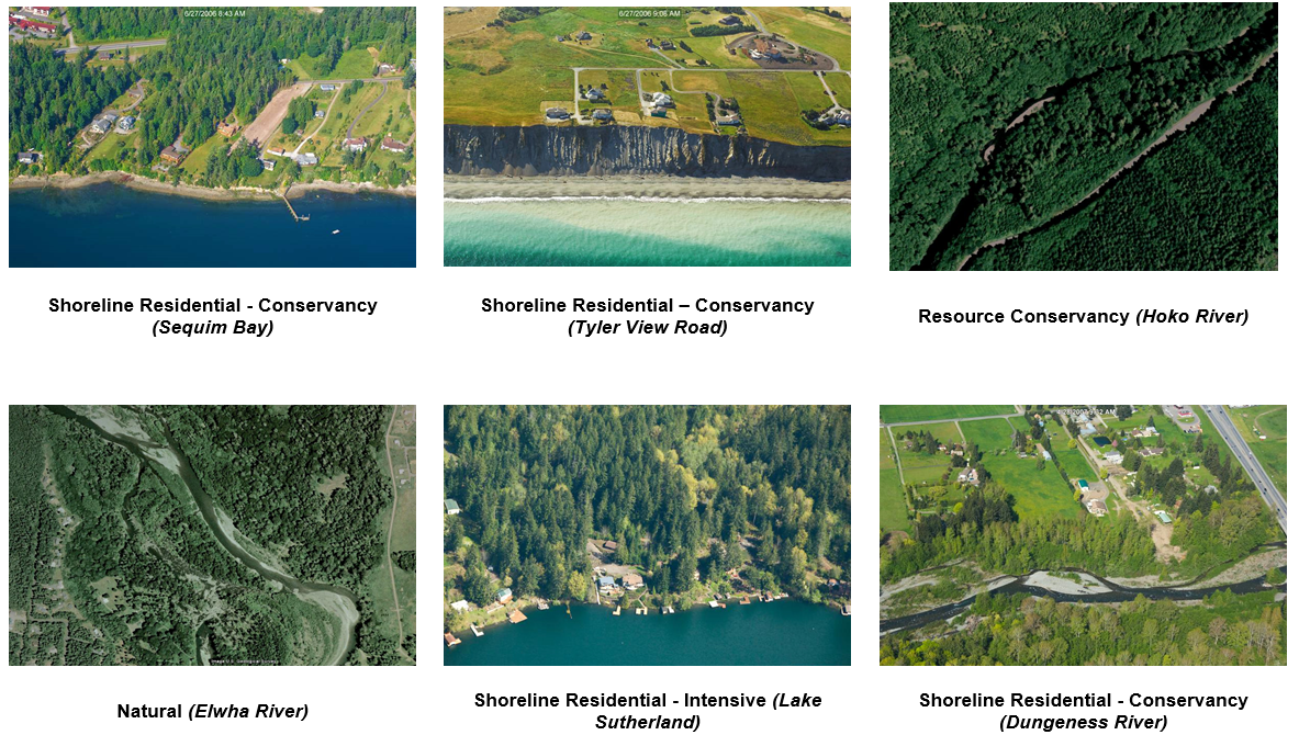
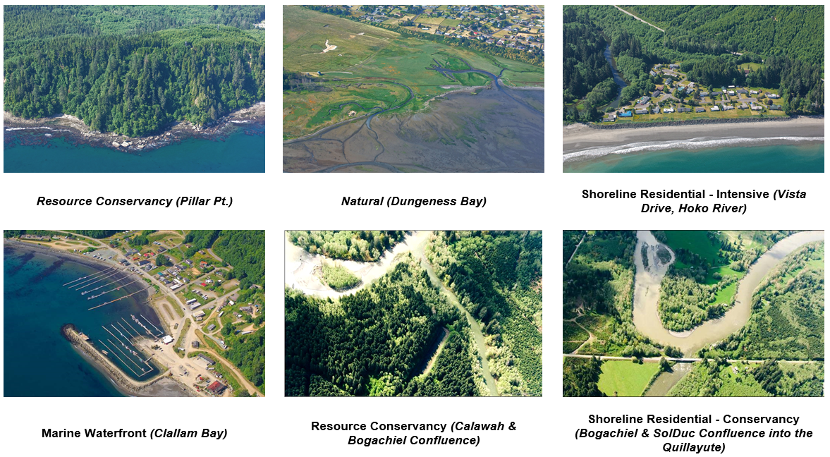
Figure 2-2. Typical examples of Shoreline Environment Designations on lakes, rivers and marine shores in Clallam County